


REQUEST A TOUR If you would like to see this home without being there in person, select the "Virtual Tour" option and your agent will contact you to discuss available opportunities.
In-PersonVirtual Tour

Listed by Andrea Wardell • Wardell & Holmes Real Estate
$ 399,000
Est. payment /mo
Active
No St Address/E 41st TER Independence, MO 64055
5.1 Acres Lot
UPDATED:
Key Details
Property Type Vacant Land
Sub Type Unimproved Land
Listing Status Active
Purchase Type For Sale
Subdivision Kerrington Woods
MLS Listing ID 2636113
Annual Tax Amount $1,785
Lot Size 5.100 Acres
Acres 5.1
Property Sub-Type Unimproved Land
Source hmls
Property Description
Use the address of: 16800 E 41st Terrace S to get to the base entry 5.17± Acres with Development Potential in Independence, Missouri
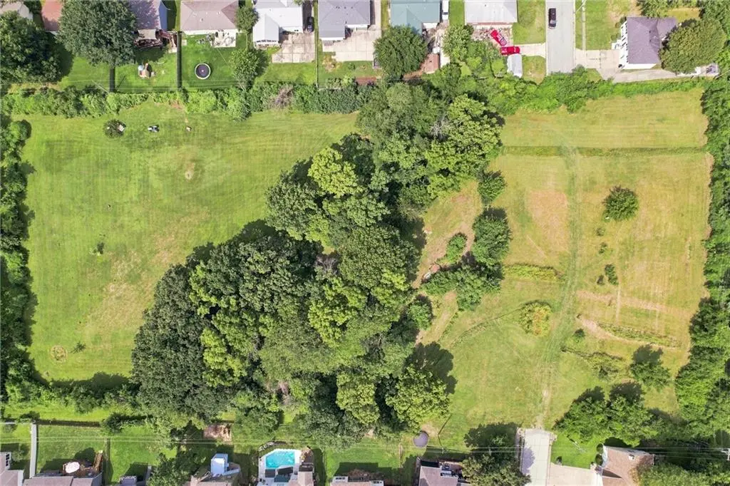
Discover approximately 5.17 acres of undeveloped land in a growing Independence location near I-70 and Missouri Route 291. Positioned between established residential neighborhoods near East 41st Terrace, this partially wooded and open parcel presents an appealing opportunity for builders, developers, or investors.
Previously marketed as having potential for approximately 15–25 residential lots, depending on lot size, engineering, zoning approval, infrastructure, and other governmental requirements. The property features sloping topography, pasture, brush, and asphalt-road proximity. Available utilities have previously been reported in the area, including electricity, natural gas, cable, and telephone service; buyers should independently confirm connection points, capacity, costs, water, and sewer availability.
Property highlights:
• Approximately 5.17 acres / 225,195 square feet
• Independence, Missouri 64055
• Near I-70 and Missouri Route 291
• Located between existing residential subdivisions
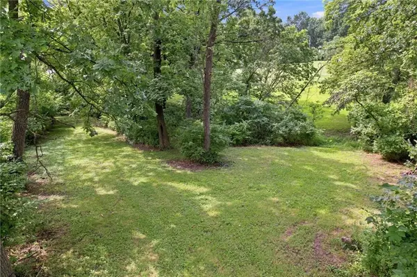
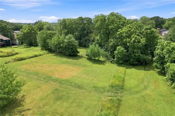
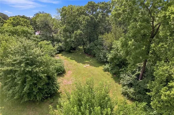
• Open pasture with brush and partially wooded areas
• Sloping topography
• No HOA previously reported
• Parcel number: 34-330-12-17-00-0-00-000
• Coordinates: approximately 39.04326 latitude
• No street address currently assigned
Bring your vision and explore the possibilities offered by this conveniently located acreage. Contact the listing agent for pricing, supporting property information, showing instructions, and due-diligence materials.
Buyer and buyer's agent should independently verify acreage, boundaries, legal access, zoning and permitted uses, development density, utilities, floodplain status, schools, taxes, and all other information. Any conceptual lot count is an estimate only and is not guaranteed.
Discover approximately 5.17 acres of undeveloped land in a growing Independence location near I-70 and Missouri Route 291. Positioned between established residential neighborhoods near East 41st Terrace, this partially wooded and open parcel presents an appealing opportunity for builders, developers, or investors.
Previously marketed as having potential for approximately 15–25 residential lots, depending on lot size, engineering, zoning approval, infrastructure, and other governmental requirements. The property features sloping topography, pasture, brush, and asphalt-road proximity. Available utilities have previously been reported in the area, including electricity, natural gas, cable, and telephone service; buyers should independently confirm connection points, capacity, costs, water, and sewer availability.
Property highlights:
• Approximately 5.17 acres / 225,195 square feet
• Independence, Missouri 64055
• Near I-70 and Missouri Route 291
• Located between existing residential subdivisions
• Open pasture with brush and partially wooded areas
• Sloping topography
• No HOA previously reported
• Parcel number: 34-330-12-17-00-0-00-000
• Coordinates: approximately 39.04326 latitude
• No street address currently assigned
Bring your vision and explore the possibilities offered by this conveniently located acreage. Contact the listing agent for pricing, supporting property information, showing instructions, and due-diligence materials.
Buyer and buyer's agent should independently verify acreage, boundaries, legal access, zoning and permitted uses, development density, utilities, floodplain status, schools, taxes, and all other information. Any conceptual lot count is an estimate only and is not guaranteed.
Location
State MO
County Jackson
Zoning Res
Interior
Fireplace N
Exterior
Fence Other
Utilities Available Cable Available, Electricity - Verify, Natural Gas Available, Phone Available
Building
Lot Description City Limits, Estate Lot, Pond(s), Many Trees
Sewer Unknown
Water Unknown - Verify
Schools
Elementary Schools William Yates
Middle Schools Delta Woods
High Schools Blue Springs
School District Blue Springs
Others
Acceptable Financing Cash, Conventional, USDA Loan, VA Loan
Listing Terms Cash, Conventional, USDA Loan, VA Loan

NEARBY SCHOOLS

GET MORE INFORMATION
Follow Us